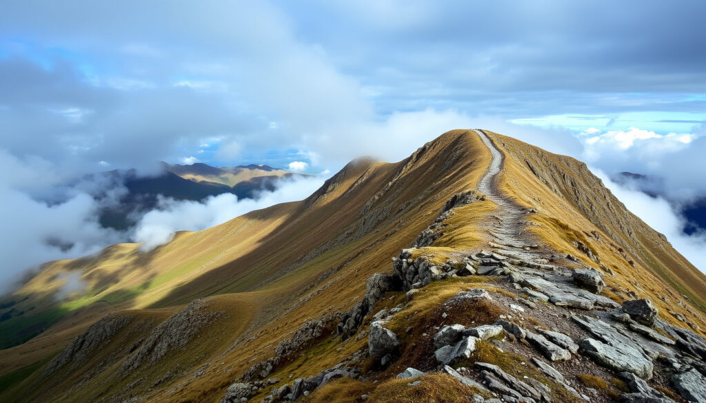
Slieve Donard Hiking Guide: Height, Routes, Difficulty
There’s something about a mountain that pulls you upward, and Slieve Donard does that with quiet authority — the highest peak in Northern Ireland, rising 850 meters above the Mourne coast. Whether you’re a seasoned hiker ticking off peaks or a curious beginner testing your legs, this guide gives you the route details, difficulty ratings, and honest comparisons you need to plan a safe and rewarding day on the mountain.
Height: 850 m (2,790 ft) ·
Location: Mourne Mountains, County Down, Northern Ireland ·
Round-trip time: 4–5 hours via the Glen River route ·
Difficulty: Moderate to hard ·
Elevation gain: Approximately 700 m ·
Significance: Highest peak in Northern Ireland
Quick Snapshot
- Height is 850 m (2,790 ft) per multiple official sources (Outsider Magazine)
- Located in Mourne Mountains, County Down, Northern Ireland (WalkNI)
- Glen River route is the most popular and easiest (The Irish Road Trip)
- Exact difficulty rating varies by conditions and individual fitness
- Duration may be longer in adverse weather
- Elevation gain varies between 700 m and 853 m depending on route and source
- No significant timeline developments — stable and well-documented hiking destination
- Plan your ascent via the Glen River route starting from Donard Park (10Adventures)
- Check weather forecasts and trail conditions before heading out (10Adventures)
Key specifications for Slieve Donard:
| Attribute | Value |
|---|---|
| Height | 850 meters (2,790 feet) |
| Prominence | ~700 m |
| Rank (Northern Ireland) | 1st |
| Rank (Ireland overall) | 7th |
| Nearest town | Newcastle, County Down |
| Mountain range | Mourne Mountains |
How long does it take to walk up Slieve Donard?
Average time from Glen River route
- The classic Glen River route takes 4 to 5 hours round trip, according to Outsider Magazine (an Irish outdoor publication).
- Countryfile (a UK countryside magazine) lists the walk as 5.8 miles (9.3 km) with a 4.5-hour duration.
- The Irish Road Trip describes the route as about 4.6 km one way, or 9.2 km in total.
Factors affecting time
- Fitness level — a fit hiker may complete the route in under 4 hours, while a slower pace with breaks can stretch toward 5.5 hours.
- Weather conditions — rain, wind, and poor visibility slow your pace and increase resting time.
- Mountain Ways Ireland states that the Glen River track is just over 9 km long with 853 m of height gain.
- TrailTrack gives the Glen River out-and-back route as 9.4 km with 840 m ascent.
Time from other routes
- Alternative approaches via the Trassey Track to Hare’s Gap and the Brandy Pad add time, typically 6–7 hours for the full circuit.
- Mountain Trails Ireland classifies the climb as strenuous and gives a duration of 7 hours with an age requirement of 13 plus.
The pattern: whatever route you choose, you’re committing to at least half a day on the mountain. The Glen River route is the efficient choice — the other paths buy you variety but cost you time and energy.
Is Slieve Donard hard?
Difficulty rating
- Countryfile rates the walk as “challenging.”
- TrailTrack labels it “strenuous.”
- The Bushwalking Blog says the trail is about 10 km long, takes 4 hours, and is “easy to moderate.”
Technical challenges
- Steep sections, particularly the final climb beside the Mourne Wall — a continuous slope for 1000 feet, per Rexby.
- No scrambling required — this is a walking route, not a climbing route.
- The terrain includes old woodland (Scots Pine, Oak, and Birch) before opening onto bare mountain ground, per WalkNI.
Fitness requirements
- You’ll gain roughly 700–850 m of elevation over 9–10 km, which demands cardiovascular endurance.
- Walking poles help on the descent, especially on loose stone near the summit.
- Good ankle support is essential on uneven, rocky sections.
Beginner considerations
- Beginner hikers can attempt the route with proper preparation, good weather, and a realistic pace.
- Our Family Hikes notes that Slieve Donard has a summit elevation of 850 m and the hike takes over 4 hours.
- The route is not technical, so the main challenges are stamina and weather, not skill.
The implication: “hard” here means sustained effort, not danger. For a reasonably fit adult, Slieve Donard is achievable as a first big mountain — but it will test your legs and your resolve on the final push.
What is the height of Slieve Donard?
Exact height and prominence
- Slieve Donard stands at 850 meters (2,790 feet) above sea level (Outsider Magazine).
- Prominence is approximately 700 m, making it a highly distinct peak.
- Our Family Hikes confirms the summit elevation of 850 m.
Ranking in Ireland and Northern Ireland
- 1st in Northern Ireland.
- 7th highest in Ireland overall.
- The second-highest peak in the Mournes is Slieve Commedagh at 767 m.
Comparison to other Mourne peaks
- Only three Mourne peaks exceed 700 m: Slieve Donard (850 m), Slieve Commedagh (767 m), and Slieve Binnian (747 m).
- For context, Carrauntoohil in County Kerry is Ireland’s highest at 1,038 m, making Slieve Donard about 82% of its height.
What this means: Slieve Donard isn’t just a hill — it’s the anchor of the Mourne range, with a prominence that gives you commanding views and a legitimate sense of scale for the region.
| Peak | Height (m) | Prominence (m) | Difficulty |
|---|---|---|---|
| Slieve Donard | 850 | ~700 | Moderate to hard |
| Slieve Commedagh | 767 | ~200 | Moderate |
| Slieve Binnian | 747 | ~150 | Moderate |
What is the easiest route up Slieve Donard?
Glen River route details
- The Glen River route starts at Donard Park in Newcastle, just off Bryansford Road (10Adventures).
- The route follows the Glen River valley, crossing three bridges over the river along the way (WalkNI).
- The trail passes through old woodland — Scots Pine, Oak, and Birch — before reaching open mountain ground (WalkNI).
- At the Donard-Commedagh saddle, turn left and follow the Mourne Wall steeply uphill to the summit (TrailTrack).
Alternative routes
- The Trassey Track to Hare’s Gap and the Brandy Pad offer a longer, more scenic approach from the west.
- These alternatives are less direct and add several kilometers to the round trip.
Which route is best for beginners
- The Glen River route is the standard and easiest, with clear signage and steady, logical progression.
- It’s approximately 9 km round trip — a manageable distance for a first big hike.
The pattern: the Glen River route wins on simplicity and accessibility. The alternatives offer wilder scenery but demand more of your legs and your day.
What accommodation and dining options are near Slieve Donard?
Slieve Donard Hotel
- The Slieve Donard Hotel is a luxury resort at the base of the mountain in Newcastle, offering spa facilities, fine dining, and direct access to the trailhead.
Restaurants in Newcastle
- Newcastle has multiple restaurants, pubs, and cafes along the main street, serving everything from fish and chips to modern Irish cuisine.
Other accommodation
- Various B&Bs and guesthouses are available in Newcastle, offering budget-friendly options for hikers.
The trade-off: staying at the Slieve Donard Hotel gives you convenience and comfort, but you’ll pay resort prices. A B&B in Newcastle offers better value and puts you just minutes from the trailhead anyway.
Confirmed Facts vs. What’s Unclear
Confirmed Facts
- Height is 850 m (2,790 ft) per multiple official sources (Outsider Magazine)
- Located in Mourne Mountains, County Down, Northern Ireland (WalkNI)
- Glen River route is the most popular and easiest (The Irish Road Trip)
What’s Unclear
- Exact difficulty rating varies by conditions and individual fitness
- Duration may be longer in adverse weather
- Elevation gain varies between 700 m and 853 m depending on route and source
The Glen River route is the most direct and well-marked path to the summit, but the final climb beside the Mourne Wall demands respect.
Based on route descriptions from WalkNI
With 850 meters of elevation and over 9 kilometers of terrain, Slieve Donard offers a genuine mountain experience without technical climbing requirements.
Synthesized from Outsider Magazine and TrailTrack
Slieve Donard is what it actually is: a demanding but achievable mountain hike, not a technical climb and not a casual stroll. For beginners with reasonable fitness, the Glen River route is the clear recommendation — start early, pack layers, and respect the weather. For experienced hikers, the mountain still rewards with sweeping views and a genuine sense of accomplishment — but the comparison to Carrauntoohil shows that bigger challenges await in Kerry. For Newcastle and the Mourne tourism economy, Slieve Donard is the anchor attraction that brings hikers to the region, and the supporting infrastructure — hotels, B&Bs, and restaurants — is built for exactly that.
Related reading: Slieve Donard walk guide · Slieve Donard via Glen River
Frequently Asked Questions
What is the best time of year to climb Slieve Donard?
The best time is May through September, when daylight is long and conditions are generally more stable. Spring and autumn can offer crisp, clear days but require more layers.
Are dogs allowed on Slieve Donard?
Yes, dogs are allowed on the trail, but they should be kept under control, especially near livestock on open mountain ground. Bring water for your dog and be prepared for rocky terrain.
Is there parking near the trailhead?
Donard Park in Newcastle has a car park, though it fills quickly on weekends and holidays. Arrive early to secure a spot.
What is the weather like on Slieve Donard?
Mountain weather is changeable. Even on warm summer days, the summit can be windy and cold. Check the forecast before setting out and carry waterproof layers.
Do I need a permit to hike Slieve Donard?
No permit is required. The mountain is open to the public, though access can be restricted during periods of high fire risk.
Can you see the Isle of Man from the summit?
On clear days, the Isle of Man is visible across the Irish Sea. Visibility varies with atmospheric conditions.
How does Slieve Donard compare to Carrauntoohil?
Carrauntoohil is Ireland’s highest peak at 1,038 m and requires more endurance and some scrambling. Slieve Donard is lower at 850 m but offers a demanding sustained climb without technical sections.
Related Reading
- Slieve Donard via Glen River (WalkNI — official walking route)
- The Slieve Donard Walk (The Irish Road Trip — travel guide)
Beginner hikers face a manageable but challenging 4–5 hour commitment; experienced hikers get a worthy workout without technical risk. Either way, the Glen River route is your best bet.
For outdoor enthusiasts visiting Northern Ireland, Slieve Donard is the region’s flagship climb — a bucket-list peak whose accessibility makes it achievable for many.
More related posts
 Katie Derham: Current Role, Salary, and Strictly Win
 Club de Nuit Intense Man: Scent, Versions, Aventus Comparison
 Juice WRLD Death: Story, Last Words, Eminem & 999 Meaning
 London Bridge Train Station – Timetable, Map and Facilities Guide
 Maiden Names: Definition, Examples, and How They’re Used
 Kaia Gerber Now: Relationship, Height, Career & Net Worth
 Amadou Onana Injury: ACL Rupture at World Cup and His Career
 Roxy Horner: Type 1 Diabetes, Marriage, and Career